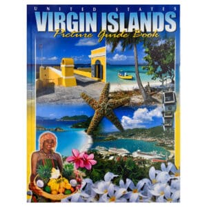
United States Virgin Islands Picture Guide Book
Take a virtual trip to three of the world’s most beautiful islands, St. Thomas, St. John, and St. Croix, by reading through this picture guidebook.
Take a virtual trip to three of the world’s most beautiful islands, St. Thomas, St. John, and St. Croix, by reading through this picture guidebook.
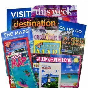
You will find guides and maps for St. Croix, St. Thomas, and St. John in this vacation planning packet. The travel information will help you

The St. Thomas and St. John travel guides and maps in this packet will help you to plan your visit to the islands. This 2024
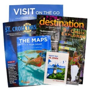
Plan your vacation to St. Croix, US Virgin Islands, with the 2024 travel guides and maps found in this packet. This 2024 St. Croix visitor

This Caribbean Beaches Wall Calendar is filled with beautiful photos of the sandy shores found throughout the Caribbean including St. John, St. Thomas, Virgin Gorda,
This 2024 Virgin Islands pocket calendar is perfect for your purse, backpack, briefcase or on a small corkboard at the office. Pocket or wallet size

Last St. Croix 2024 calendar left. It has a very small superficial tear on the external cover. Not really perceivable unless you are looking for
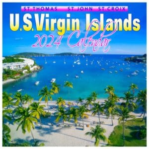
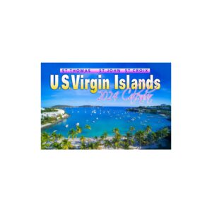
Order a beautiful 2024 Virgin Islands wall calendar. Each month features a different stunning image of the islands including St. Croix, St. Thomas and St.
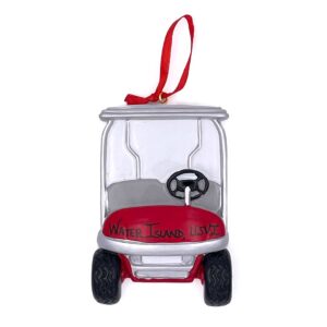
This is a fun ornament and reminder of Water Island in the US Virgin Islands, where getting around by golf cart is the most popular
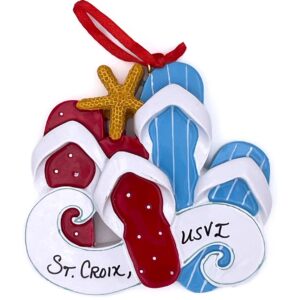
A fun and colorful St. Croix Christmas tree ornament that will remind you of your toes in the sand vacations in the US Virgin Islands.
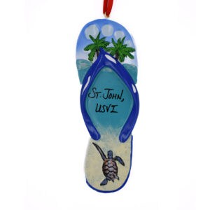
This tropical themed St. John Christmas tree ornament is designed as a flip flop with a lovely beach scene on the inner sole. The design
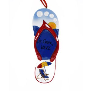
This tropical themed St. Croix Christmas tree ornament is designed as a flip flop with a lovely beach scene on the inner sole. The design
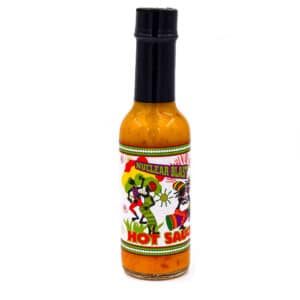
With Nuclear Blast Hot Sauce, you can add the taste of the Caribbean to your meals. This great hot sauce is very flavorful and tasty
With Nuclear Blast Hot Sauce, you can add the taste of the Caribbean to your meals. This great hot sauce is very flavorful and adds
In the Caribbean, up to not that long ago, all of our cooking was done outside, on wood fires, with a variety of seasonings. The
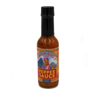
Mama Lucy Pepper Sauce, by Baron, is a favorite hot sauce in St. Lucia and throughout the Caribbean. This flavorful hot sauce is ideal in
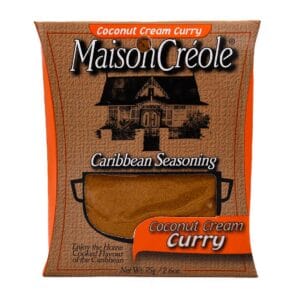
In the Caribbean, East Indians came in large numbers in the nineteenth century to work on the sugar plantations. They brought with them their culture,
You will find guides and maps for St. Croix, St. Thomas, and St. John in this vacation planning packet. The travel information will help you

Brand New – 19th Edition – Just Released May 2020. This book is a must-have whether you are considering moving to the US Virgin Islands,
With Nuclear Blast Hot Sauce, you can add the taste of the Caribbean to your meals. This great hot sauce is very flavorful and adds
