")
 Open")
$9.95
Out of stock
Description
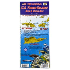
This beautiful map is full of information—a Map Guide! On side 1 are Tortola, Virgin Gorda, Jost Van Dyke as well as smaller islands: Norman Island, Peter Island, Salt Island, Cooper Island, Ginger Island, Necker Island, Mosquito Island, Beef Island, Great Camanoe and Guana Island. On side 2, you will find these islands in smaller sizes, including Anegada.
Main roads are labeled, as are areas and beaches. The mountains on the islands are shown in a smooth and wonderful green-shaded relief. The waters around the islands are shown in Caribbean-turquoise blues in descending hues to represent the depths.
The map indicates paved and dirt roads, anchorages, points of interest, and lodgings. Snorkeling sites are also labeled, as are dozens of superlative dive sites (with depth information and brief descriptions). Facts about each of the major islands are included, as well as a list of dive operators and an identification chart for fish and reef creatures commonly seen while snorkeling and diving. Material: durable, water-proof paper. Full-color, 2-sided, folding. Map size: 9.25 x 4.5 inches when closed; 18.5 x 26.5 inches when fully opened.
Additional information
| Weight | .1063 lbs |
|---|---|
| Dimensions | 9.25 × .06 × 4.5 in |
You must be logged in to post a review.
Related products
-
-
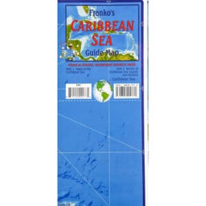
Caribbean Map
- $9.95
- Add to cart
-


Reviews
There are no reviews yet.